About
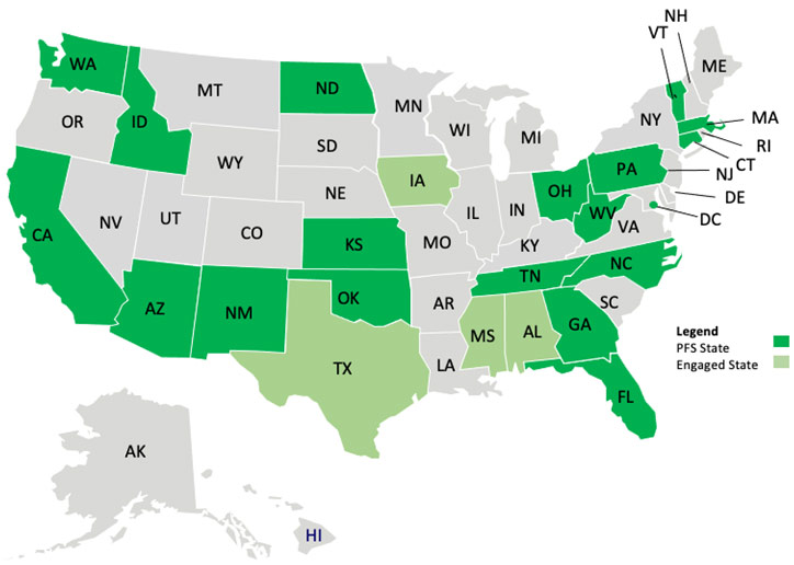
Pooled Fund Study (PFS) State Activities
Pooled Fund Study (PFS) states regularly engage in activities to advance applications of enterprise GIS in transportation.
PFS States
AEGIST Implementation Activities at PFS States
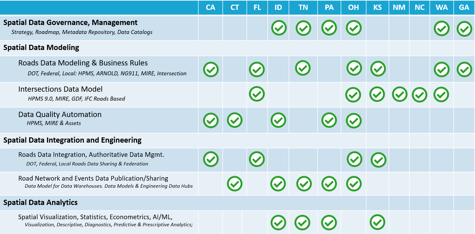
Development of the AEGIST Guidebook v2.0
Planned updates to the AEGIST Guidebook include State DOT best practices and experiences in preparing data for DOT busines users, ARNOLD, HPMS and the National Roadway Base Map (NRPBM/TFTN), including:
- Data Modeling Standards: HPMS, MIRE, NBI, NBE-BME, OGC (GDF, CityGML, InfraGML), USGS, ASPRS
- Building Information Modeling (BIM) Use Cases
- Preparing Roads and Intersection Data Model for:
- Travel Demand Modeling and Forecasting: DOT & Local Agency Systems, FHWA Office of Planning
- Traffic and Safety Business Operations: DOT Safety Analyst Systems, FHWA Office of Safety
- Asset Resiliency & Life Cycle Analysis: DOT Asset Management, VAST/TEACR Tools; FHWA: NBI, HPMS, DDIR
- Project Planning, Prioritization, Manage: DOT Project Systems, FHWA Systems: FMIS
- Freight Network Modeling: DOT Heavy Vehicle Routing, FHWA Freight Analysis Framework (FAF)
- Exchanging Roadway Alignment and Characteristics Data between GIS, LRS and Design Systems during Project Delivery (Phased exchange, Data Temporality and Asynchronous Editing)
Resources
- AEGIST Guidebook under Advanced Technical Review – Available upon request to State DOTs
- AEGIST FHWA Pooled Fund Site
How do I get involved?
Contact: Abhishek Bhargava, WSP
abhishek.bhargava@wsp.com
How does my agency benefit by getting involved?
- Receive 750 hours of services to plan and support technical priorities of Pooled Fund Study agencies.
- Receive guidance on agency-specific issues and challenges.
- Share in peer states and agency best practices information.
- Advance data modeling, integration, engineering, analysis tools and standards.